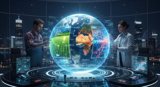
Seeing from Above: How Remote Sensing Shapes Farms, Health, and Cities
The Evolution of Farming: Precision Agriculture
Take farming. For most of history a farmer had to just walk the fields and guess. Look at the plants, feel the soil, hope for the best. You’d only notice problems when they were already big. Now, with drones or satellites passing overhead, you can see stress in crops weeks before your eyes would catch it. Parts of the field growing strong, other patches looking weak, it all shows up on those images. That’s where the whole “precision agriculture” idea comes in. Instead of treating the entire farm the same, you target water or fertilizer where it’s actually needed. Saves money, saves water, and avoids dumping chemicals everywhere. Say one corner is drying up, you just irrigate that spot. Or maybe pests show up in a small patch—you don’t spray the whole place, just there. Feels like common sense, but without remote sensing you wouldn’t even know where the problem was until it spread.
It’s not just crops either. Ranchers use it too. Satellites tracking grazing patterns, showing which fields are overused, which ones are fine. Helps keep the land healthier, which in the long run means healthier animals too. Farming always had that mix of art and instinct, but now it’s being backed up with real-time data.
A Proactive Approach to Public Health
Healthcare seems less obvious but it’s becoming a thing. A lot of diseases depend on environment. Malaria, for instance—mosquitos love warm, wet areas. Satellites can track rainfall, temperatures, standing water. Suddenly you’ve got a map showing where outbreaks are most likely before they even start. Same for dust storms or pollution that trigger asthma and breathing problems. Instead of waiting for hospitals to fill up, you can act earlier.
Even during covid, satellites played a weird role. Looking at how traffic patterns changed, or how bright cities looked at night. Those details gave clues about how lockdowns were working, how economies were restarting.
It’s not healthcare in the doctor’s-office sense, but it’s health at a bigger, population level. Air quality’s another one—satellites track gases and fine particles floating around, showing which cities have dangerous levels. And that connects straight to public health decisions.
Running the Modern Smart City
Now, smart cities. The term gets thrown around a lot, but basically it’s about using tech to run cities better. Cities are chaotic—traffic, water, electricity, housing, parks, all overlapping. Remote sensing helps untangle that. For example, satellites can spot traffic jams from above, and planners can tweak roads or public transit routes. Another big deal: heat islands. Those areas in a city where it’s way hotter because of all the concrete. Remote sensing makes those spots visible so governments know where to plant more trees or cool things down.
Planning and Disaster Lifesaver
It’s also handy for city growth. People move fast, buildings go up, neighborhoods expand. Planners can’t always keep up, but satellite images make land use clear. They show which areas are spreading fastest, where new schools or roads will be needed. And when disasters hit—floods, quakes, hurricanes—remote sensing becomes a lifesaver. Ground crews can’t see the whole picture, but updated images from above show which neighborhoods are hardest hit so help can go straight there.
The Data Challenge
What’s funny is that these three worlds—farming, health, cities—don’t seem connected at all. A farmer in Argentina, a doctor in Kenya, a city planner in Tokyo. But they’re all leaning on the same thing: solid data about the environment. Remote sensing becomes this invisible thread tying them together.
But, yeah, there are issues. The data’s huge, like overwhelming. A single hyperspectral image can take up gigabytes, and most people don’t have the tools to process that. Farmers don’t sit around with supercomputers. Cities in developing countries might not have the budget. That’s why AI gets pulled in, to chew through the numbers and spit out something useful. Still, that creates a gap—big companies and rich governments get ahead while smaller players risk falling behind. Find out more about how AI gets pulled in, to chew through the numbers and spit out something useful: AI gets pulled in.